
Page 4 - RGC Recreational Map
P. 4
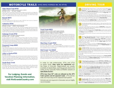
MOTORCYLE TRAILS (HIKE/BIKE/HORSES OK, NO ATVS) DRIVING TOUR
Alder Bench Trail #799 A Take Hwy 160 west of South Fork for 1.3 miles and turn left to Beaver Creek
Rd/FSR 360. After 4 miles, you can turn left up a small hill for Million
ELEVATION: 8,400 ft. to 8,900 ft. (use early summer to mid fall) Reservoir. It is a short walk to the lake, but the scenery and fishing are
DISTANCE: 1.5 miles DIFFICULTY: Moderate
Take Hwy. 149 out of South Fork towards CR 15, and when you cross the river bridge take worth it. Once you reach Beaver Creek Reservoir, you may fish, boat, or just admire
the first right. Continue along the road about 1-½ miles to the Alder Creek sign and take
a left here. Proceed approximately 2.4 miles down road 610 to the Alder Creek Guard the scenery. If you continue on for 13 more miles you will reach Poage Lake, which
Station. Trail #799 starts here, and is steep, narrow and rocky.
is a dead end. From here you have two options:
Bennet #872
1. At the “Y” turn left on FSR 332 and follow it for 1 mile until you get to a “Y” for
DISTANCE: 7 miles FSR 359 & 332. If you take FSR 322 you will meet up with FSR 330 after 8-10 miles,
From Del Norte go south on CR 13 and turn west on FSR 327, the trail starts at the end of which turns into Pinos Creek Rd (CR 14) which will bring you back to Hwy. 160 in Del
this road. Experienced ATV riders are best for this trail. Norte. If you turn right on FSR 330 you will reach the Summitville Mine.
Cathedral #794 2. If you have 4-wheel drive, take FSR 359 for 5-7 miles, then follow FSR 350 and
work your way north toward Del Norte Peak. You will reach an intersection. Turn
ELEVATION: 9,370 ft ends at 10,960 ft (use early spring to late fall) left on FSR 345 which will bring you to Hwy 160 just east of South Fork.
DISTANCE: 3.25 miles DIFFICULTY: Easy to Moderate
Go 6 miles east of South Fork on Hwy. 160. Turn left on Embargo Creek CR 18 and follow B Take Hwy 160 southwest from South Fork for 7 miles and turn left on Park
for 2 miles, turning right on CR 15 for ½ mile, then left on to FSR 650. Follow for 2 more Creek Rd FSR 380. The creek offers great fishing here. After 15 miles you will
miles turning left on FSR 640 to Cathedral Campground. The trail from the campground have 2 options:
to Cathedral Rock is the easiest to negotiate. From the rock the trail climbs and becomes
steeper and rocky until it tops out near Groundhog Park. Trout Creek #831 1. Turn left on FSR 330, and in 3 miles you will be at Summitville, a historic gold-
mining town started in 1870. Many historic buildings can be seen from a distance, as
Embargo Creek #792 ELEVATION: 8,400 ft. to 9,000 ft. (use late spring to early fall) the site is now undergoing an EPA clean up.
DISTANCE: 4 miles to the creek, 8 miles to wilderness boundary
ELEVATION: 8.500 ft to 12,000 ft. (use spring to early fall) DIFFICULTY: Hike/Horse - Moderate; Motorcycle - Difficult 2. Stay on FSR 380 and travel through Elwood Pass (rough) towards another
DISTANCE: 6 miles DIFFICULTY: Moderate Follow Hwy. 160 south out of South Fork for 2-3 miles. Approximately ¼ mile before you abandoned mine site called Stunner. If you stay on FSR 380 you will eventually wind
Go east of South Fork about 6 miles turn left on CR 18. Follow for 2 miles to CR 15 and reach Riverbend Resort there is a small turn off to the right. Follow this dirt road a few up in Platoro, 41 miles off of Hwy 160.
go right on CR 15 for ½ mile. Then go north (left) on FSR 650 for a few miles turning left hundred feet and park. After passing through the gate, follow the trail up and down then
towards Cathedral Campground on FSR 640, past the campground to the end of the road. up again and descend to the creek. This is normally an out-and-back trail, however you To return, follow the same route, or go back to Summitville and follow FSR 330 to CR
The trailhead is next to a private gate. This is a nice trail through Spruce, Aspen and by a can continue via Trail #833 back around to road 433, out to Hwy. 160. This trail offers a 14 to Del Norte.
creek with lots of beaver activity and good fishing. You may also want to try the Cathedral variety of terrain with moderate climbs. The first two miles is great for ATVs, but after
(3-¼ miles) and the Fremont Camp (3-½ miles) trails while in the area. this motorcycles are best. C Take Hwy. 160 southwest of South Fork for 11 miles and turn right on FSR
410 to Big Meadows Reservoir, a delight to campers, fisherman and
Freemont Camp #885 West Bear Creek #932 hikers. Continue past Big Meadows for 3 miles to Shaw Lake, or 11 miles to
DISTANCE: 7 miles ELEVATION: 8,400 to 9,200ft. DISTANCE: 2.5 miles a parking lot and a short ¼-mile hike into Hunters Lake – watch for moose. Return
From Cathedral campground, follow the Embargo Creek Trail to an intersection about Go north on Hwy. 149 from South Fork turning right after crossing the river to CR 15.
4 miles up. You will drop down to the right towards the creek. Follow this trail for another After following CR 15 for 2-½ miles, turn left on FSR 614 to Bear Creek. You will drive up to South Fork, or turn right on Hwy 160, and after 2 miles turn left onto FSR 390
couple of miles, and once you clear the trees you will see the trail on the other side of the this road another 2 miles to the trailhead.
meadow across the creek. toward Pass Creek. After 3 miles you will reach Tucker Ponds which offers
Wolf Creek Trail #849
Little La Garita #793 handicap-accessible fishing.
ELEVATION: 9,800ft. DIFFICULTY: Expert
DISTANCE: 11.3 miles Not to be confused with Wolf Creek Pass, this trail starts on FSR 340. To access the For more adventure, continue up Hwy 160 to the Wolf Creek Ski Area. 2 miles past
Go north from Del Norte on Hwy. 112 for 2 miles and turn left on CR 33 and continue for 7 trail, travel 2 miles east on Hwy. 160 to the Del Norte Peak and Willow Park access road the ski area turn right on FSR 401 and follow it to the top of Thunder Mountain and
miles. Turn left here on FSR 670 and go 5 more miles to the trailhead. This is part of the on the right. Take FSR 345 for about 4 miles to FSR 340 and follow for another 2-½ Lobo Overlook for a view of the Continental Divide.
old Stock Driveway and will take you through a variety of scenic views, vegetation and miles to the trailhead. This trail is motorized but is not well suited as a touring trail. It
elevations. Mesa Mountain stands at over 13,000 feet elevation and offers spectacular dead ends at private property. The trail goes down a steep section at the start and can D (4-WHEEL DRIVE) Take Hwy 149, turning right after the river on CR 15. After
views of the San Luis Valley. be tough to climb back up if it rains or snows. For experienced ATV riders. 1-¼ miles, turn left on Alder Creek Rd/FSR 610. This is the canyon that John
South Rock Creek In order to ride motorcycles, ATVs and UTVs Freemont is believed to have traveled when he lost all of his horses, mules
on public lands, they must be registered with
DISTANCE: 1.95 miles the State of Colorado. Registrations are usually and 11 men looking for a railroad route. At the Round Park turnoff (7 miles above the
From Monte Vista, follow State Rd 15 for 2 miles to South Rock Creek Rd. 265 and follow available at dealerships, sporting goods stores and
for 22 miles to the end of the road, where parking and the trail begin. Excellent ATV route. online at the Colorado Parks & Wildlife website at Guard Station) you have two options:
Routes 703, 704, 761 & 934 are also motorcycle routes. Please contact the Visitors’ cpw.State.Co.Us/.
Center or National Forest Service Offices for a Motor Vehicle Use Map. 1. Turn right on FSR 611 and return to South Fork after 22 miles on the Aqua Ramon
ATVs less than 50” wide are allowed on the ATV Rd FSR 630.
For Lodging, Events and trails system and all unpaved roads. UTVs are too
Vacation Planning Information, wide and must stay on the unpaved road system. 2. Continue left for 11.5 miles to FSR 610 which will take you to the Hansen Saw Mill
site. From here follow FSR 600 for 10 miles to Hwy 149. Or, if you are ready for an
visit RioGrandeCountry.com Helmets are not required in Colorado, but are highly adventure, take the turn for Wheeler Geological Area, a rough 14-mile journey, and
recommended. well worth the amazing geological formations at the end.
E Follow Hwy 149 for a 135-mile journey from South Fork to Gunnison, along
the Silver Thread Scenic Byway, including stops along the way detailing the
areas history, geology, scenery and wildlife. Creede and Lake City are great
stops for lunch and museums detailing how and why the region was first settled.
F Take Hwy. 149, turning right on CR 15 after crossing the river. Heading east
toward Del Norte, past the Rio Grande Golf Club. 5 miles past the golf course
you will find Colonel Pfeiffers’s grave marker on the left side of the road.
Take a short hike up the hill to the gravesite. If you are interested in geology, Indian lore
and flora, head on to Old Women’s Creek FSR 600. Travel for 9 miles, then turn left on
FSR 659, and you will see the Natural Arch. The pinon tree in the window is over 100
years old. You will also see boulder fields, ancient volcanoes and dikes. From here you
can go back the way you came, or take FSR 660 east and either turn right on CR
33/38A to the Elephant Rocks, or turn left on CR 33/38A and go on to La Garita.
SHORTCUT: Take Hwy 160 to Del Norte, turn left at the stop light to Hwy 112, go 5
miles and turn left on CR33/38A straight to La Garita, and then on to the Natural Arch.
G Go east on Hwy. 160 for 2 miles, turn right on FSR 345 to Willow Park/
Del Norte Peak. After 5 miles you will come to an intersection. FSR 345 dead
ends near a hiking trail to the top of Del Norte Peak. Or, with 4-wheel drive,
take the right turn to FSR 350 which will intersect with FSR 359 going toward Poage
Lake, then onto Beaver Creek Reservoir and back to Hwy 160 and South Fork.